Trail Walking Les Allues - Refuge du Saut - Photo
 Hubert78
Hubert78

User

© OpenStreetMap contributors
Length
Length
16.1 km
Max alt
Max alt
2141 m
Uphill gradient
Uphill gradient
536 m
Km-Effort
Km-Effort  
23 km
Min alt
Min alt
1686 m
Downhill gradient
Downhill gradient
529 m
Boucle
Boucle
No
Creation date :
2016-07-14 00:00:00.0
Updated on :
2016-07-14 00:00:00.0

(0 Reviews)

Walking
Walking
4h59
Difficulty : Medium

Scan this QR Code to open this trail in the SityTrail application

FREE GPS app for hiking

Logo SityTrail SityTrail

IGN / Geographical institutes

Download SityTrail from the App Store Download SityTrail from Google Play

Logo SityTrail SityTrail World

The world is yours!

Download SityTrail from the App Store Download SityTrail from Google Play Download SityTrail on Huawei AppGallery

About

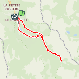
Trail Walking of 16.1 km to be discovered at Auvergne-Rhône-Alpes, Savoy, Les Allues. This trail is proposed by Hubert78.

Description

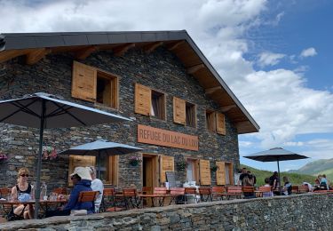
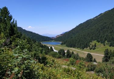
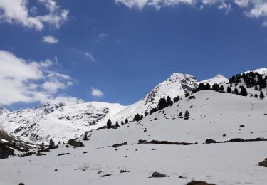
Très beaux paysages. Possibilité de repas ou nuit au refuge.

Elevation profile

Photos

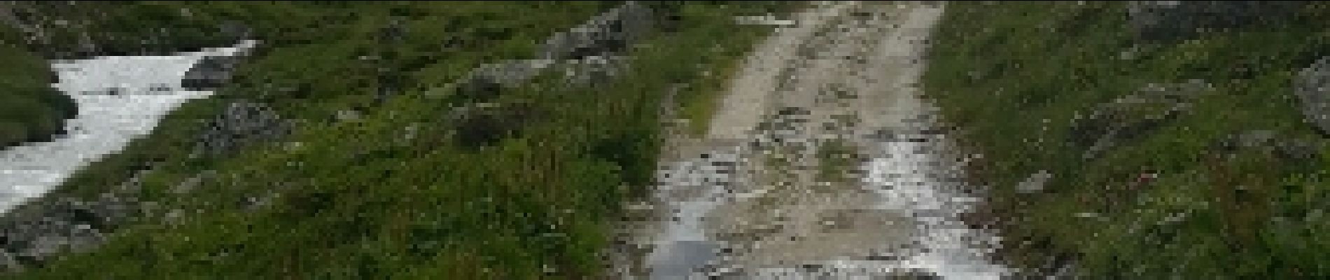
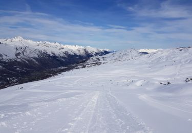
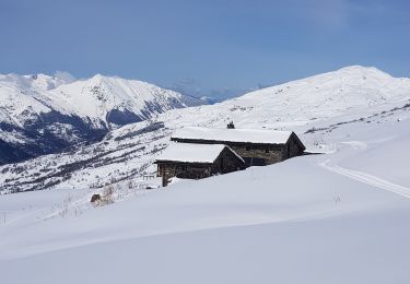
34 photos in total. Please click on a photo to see them all in the gallery.

Positioning

Country:
France
Region :
Auvergne-Rhône-Alpes
Department/Province :
Savoy
Municipality :
Les Allues
Location:
Unknown
Start:(UTM)
310768 ; 5026852 (32T) N.

Trails nearby

Trail Walking Courchevel - lac des creux au départ de l'altiport  - Photo
Walking
Klhn

Walking

Easy
(1)
Courchevel, Auvergne-Rhône-Alpes, Savoy, France
6.8 km | 11.1 km-effort
2h 40min
Yes
Trail Walking Les Belleville - Le sentier des Choumes ( N °9) - Photo
Walking
GUIDE
mumu.larandonneuse

Walking

Easy
Les Belleville, Auvergne-Rhône-Alpes, Savoy, France
6.7 km | 8.8 km-effort
1h 36min
No
Trail Walking Les Belleville - Le sentier Giraud - N° 8 - Photo
Walking
GUIDE
mumu.larandonneuse

Walking

Easy
Les Belleville, Auvergne-Rhône-Alpes, Savoy, France
5 km | 6.5 km-effort
1h 9min
No
Trail Walking Les Belleville - La Croisette  - Le Plan d'eau des Bruyères  - Photo
Walking
GUIDE
mumu.larandonneuse

Walking

Easy
Les Belleville, Auvergne-Rhône-Alpes, Savoy, France
7.7 km | 10.5 km-effort
1h 53min
Yes
Trail Other activity Les Allues - meribel ski 2 - Photo
Other activity
Cricounet84

Other activity

Medium
(1)
Les Allues, Auvergne-Rhône-Alpes, Savoy, France
67 km | 163 km-effort
5h 12min
Yes
Trail Walking Les Allues - Col du Souffre et Lacs Mont-Coua - Photo
Walking
tracegps

Walking

Difficult
(1)
Les Allues, Auvergne-Rhône-Alpes, Savoy, France
25 km | 41 km-effort
7h 0min
Yes
Trail Other activity Les Belleville - Menuires Lac du Loup - Photo
Other activity
jpksenicz

Other activity

Very easy
Les Belleville, Auvergne-Rhône-Alpes, Savoy, France
14.5 km | 21 km-effort
1h 26min
No
Trail Walking Les Belleville - crêtes de Méribel depuis Tougnete - Photo
Walking
bymarc26

Walking

Medium
Les Belleville, Auvergne-Rhône-Alpes, Savoy, France
14.7 km | 23 km-effort
4h 8min
No
Trail Walking Les Allues - Lac Tueda et Vallon du Fruit depuis Méribel - Photo
Walking
jpduc

Walking

Easy
Les Allues, Auvergne-Rhône-Alpes, Savoy, France
7 km | 11.2 km-effort
2h 44min
Yes


Close
My subscriptions